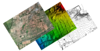
Job Oriented Survey Programs
Get upskilled in Survey Technologies
At ‘The Learning Minds,’ we are committed to providing a diverse range of educational opportunities, including courses that equip you with practical skills in the field of survey technology. Our programs are designed to meet the growing demand for professionals in Surveying, Mapping, and Geospatial fields.
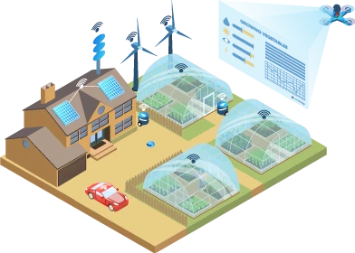
Did You Know?
Drones are used to measure Distance, Area & Volume of a region
Job Oriented Programs in Survey Technology
Survey Courses in Hassan
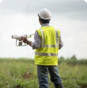
Drone Survey
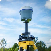
DGPS Techniques
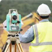
Total Station Survey
Best Survey Training in Hassan
Syllabus – Total Station Survey
Weekdays & Weekend Classes available
Week 1
Introduction to Total Station
Day 1: Introduction to Surveying
- Introduction to Surveying and Total Station Technology
- Understanding Coordinate Systems
- Setting Up and Calibrating the Total Station
Day 2: Measurement Techniques
- Basic Measurements and Distance Measurement Techniques
- Practicing Distance Measurements with Total Station
Day 3: Angle Measurements and Angular Units
- Angle Measurements and Angular Units
- Performing Angle Measurements with Total Station
Day 4: Data Recording
- Data Recording and Note Keeping in Surveying
- Fieldwork: Conducting Simple Surveys
Day 5: Error Minimization Techniques
- Error Sources in Surveying and Error Minimization Techniques
- Hands-On: Error Identification and Correction
Week 2
Advanced
Day 6: Advanced Surveying Techniques
- Advanced Surveying Techniques: Traverse Survey
- Performing Traverse Surveys with Total Station
Day 7: Total Station Data Processing
- Total Station Data Processing and Analysis
- Introduction to AutoCAD for Surveyors
Day 8: Topographic Surveying
- Topographic Surveying and Contour Mapping
- Creating Topographic Maps Using Total Station Dat
Day 9: Cadastral Survey
- Cadastral Survey and Boundary Determination
- Legal Aspects of Land Surveying
Day 10: Practical Survey Project
- Final Practical Survey Project
- Data Presentation and Reporting
Students will be taken to field projects to gain practical knowledge.
Syllabus – DGPS course
Weekdays & Weekend Classes available
Week 1
Introduction to DGPS
Day 1: Introduction to DGPS and Navigation Basics
- Introduction to GPS, GNSS, and DGPS
- Understanding latitude, longitude, and elevation
- Basic principles of satellite navigation
Day 2: Understanding GPS and DGPS Technology
- Components of a GPS system
- DGPS vs. Autonomous GPS: Accuracy differences
- GPS signal structure and acquisition
Day 3: Principles of Differential GPS
- Concept of differential correction
- Sources of GPS errors
- Real-time vs. post-processed DGPS
Day 4: DGPS Equipment Setup and Calibration
- Setting up DGPS receivers and antennas
- Configuring correction sources
- Calibration procedures and best practices
Day 5: Hands-On DGPS Data Collection
- Field data collection using DGPS equipment
- Practical exercises in data logging
- Troubleshooting common field issues
Week 2
Advanced DGPS Applications
Day 6: DGPS Data Post-Processing and Analysis
- Post-processing DGPS data for accuracy enhancement
- Analyzing GPS data with software tools
- Quality control and error assessment
Day 7: GIS Integration and Mapping with DGPS Data
- Integrating DGPS data into GIS platforms
- Creating maps and geospatial databases
- Case studies in GIS applications
Day 8: Real-Time Kinematic (RTK) DGPS
- Understanding RTK DGPS principles
- Setting up and using RTK equipment
- Achieving centimeter-level accuracy in real-time
Day 9: DGPS in Agriculture
- Case studies in agriculture and environmental sectors
Day 10: Practical Survey Project
- Collaborative DGPS project work
- Presentation of individual and group projects
Students will be taken to field projects to gain practical knowledge.
Syllabus – Drone Survey
Weekdays & Weekend Classes available
Section 1
Introduction to Aerial Mapping
Day 1: Drone technology in surveying
- Overview of drone technology in surveying
- Understanding the role of drones in data collection
- Safety protocols and regulations for drone operation
Day 2: Drone Flight Planning and Control
- Types of drones and their applications
- How to choose the right drone for your surveying needs
- Hands-on drone assembly and setup
Day 3: Aerial Imaging and Photogrammetry
- Flight planning software and tools
- Pre-flight checklists and safety measures
- Practical drone flight exercises
Day 4: Data Recording
- Basics of aerial photography and image acquisition
- Introduction to photogrammetry and 3D modeling
- Processing aerial images for mapping
Day 5: Error Minimization Techniques
- Managing and organizing drone survey data
- Introduction to GIS software for data analysis
- Post-processing techniques for accuracy enhancement
Section 2
Data Processing
Day 6: Data Management and Post-Processing
- Topographic mapping using drone data
- Creating contour maps and elevation models
- Practical exercises in topographic mapping
Day 7: Outputs & Use cases
- Building 3D models from drone imagery
- Generating Digital Surface Models for analysis
- Case studies in 3D modeling applications
Day 8: Practical Survey Project
- Precision agriculture and crop monitoring
- Environmental assessments using drone data
- Real-world examples in agriculture and environment
Day 9: Cadastral Survey
- Integrating RTK GPS with drones for higher accuracy
- RTK setup and calibration
- Achieving centimeter-level precision in drone surveys
Day 10: Practical Survey Project
- Collaborative drone survey project work
- Presentation of individual and group projects
Students will be taken to field projects to gain practical knowledge.
Download Course Syllabus
Course Details
You only need interest in learning new things & Practice Practice Practice…
Eligibility for Survey Technology courses: 12th/PUC Passed. Degree in Science background preferred.
Projects are given as home works & portfolio generation.
Weekend classes are available based on the number of students.
Only 5 students per batch
Complete job assistance guarenteed
